July 2015 Lake Ozark Flood
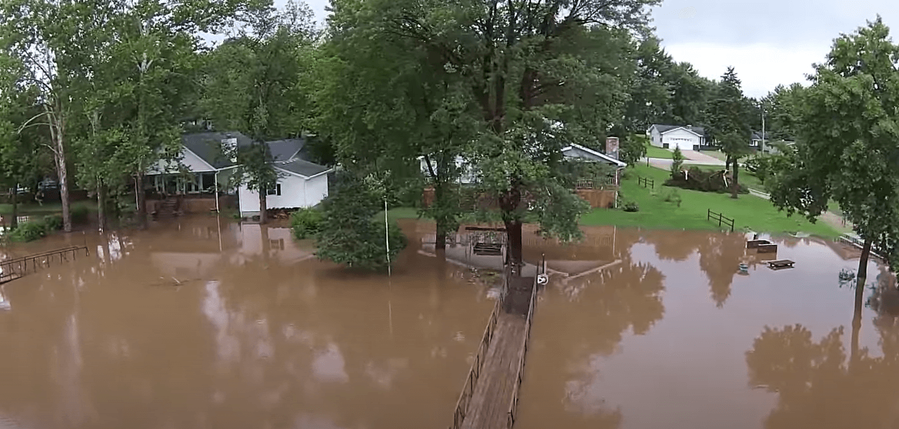
On July 2nd, 2015 I drove out to Camdenton Missouri to visit the Lake of the Ozarks for July 4th. Having visiting the area many times before I tended to refer to the water as low or high based if the rocks on the seawall were visible or not. Arriving this time was the largest I'd ever seen the lake and we had already passed the point of damaging.
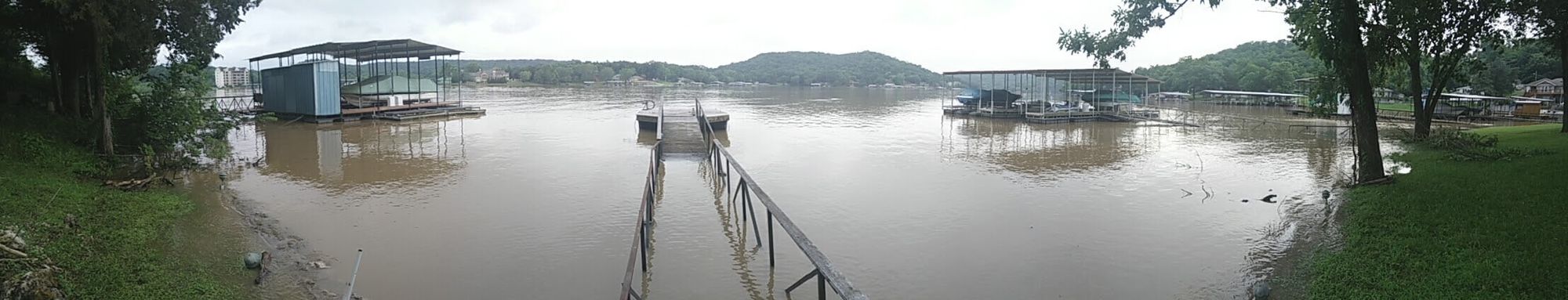
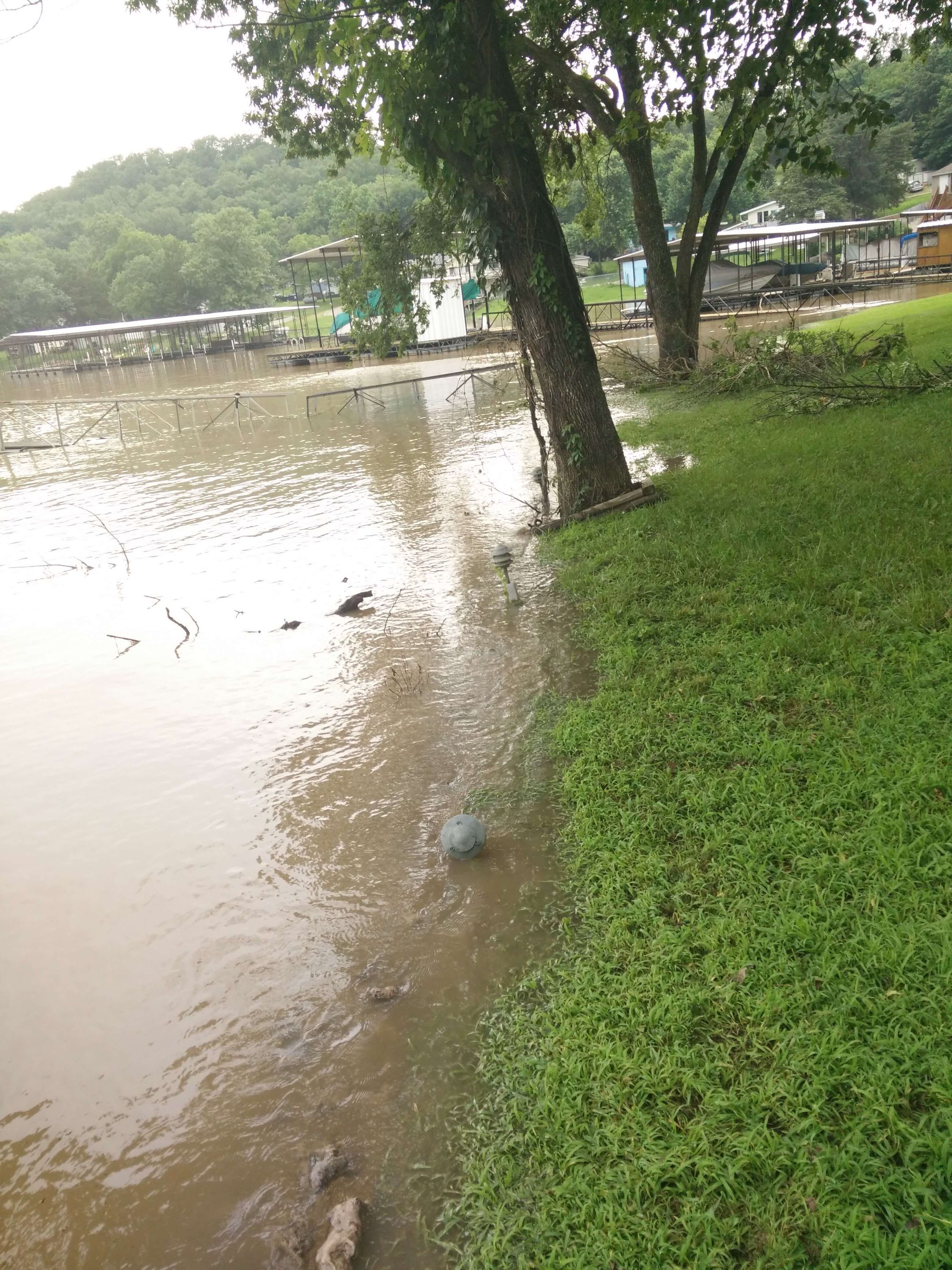
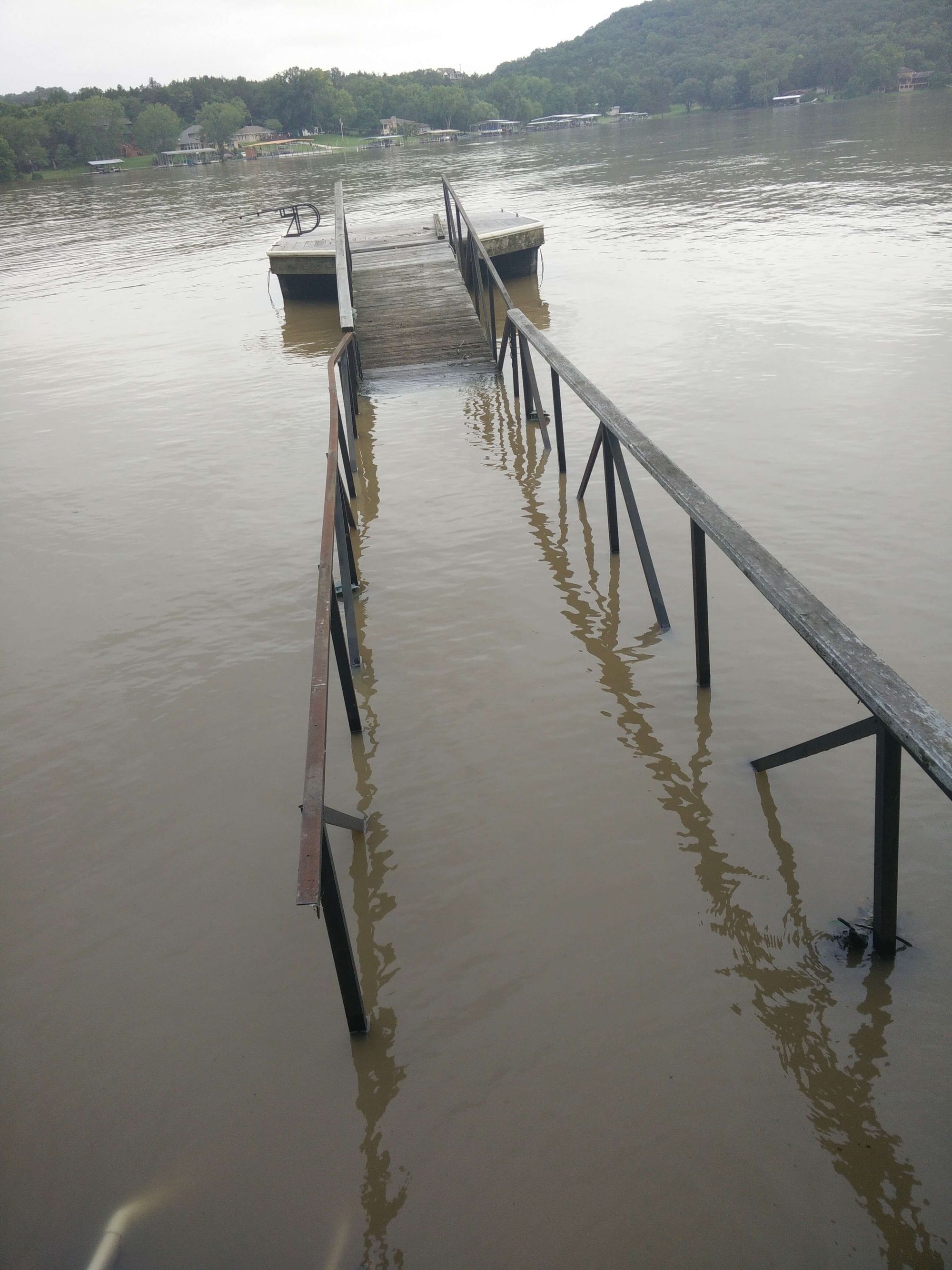
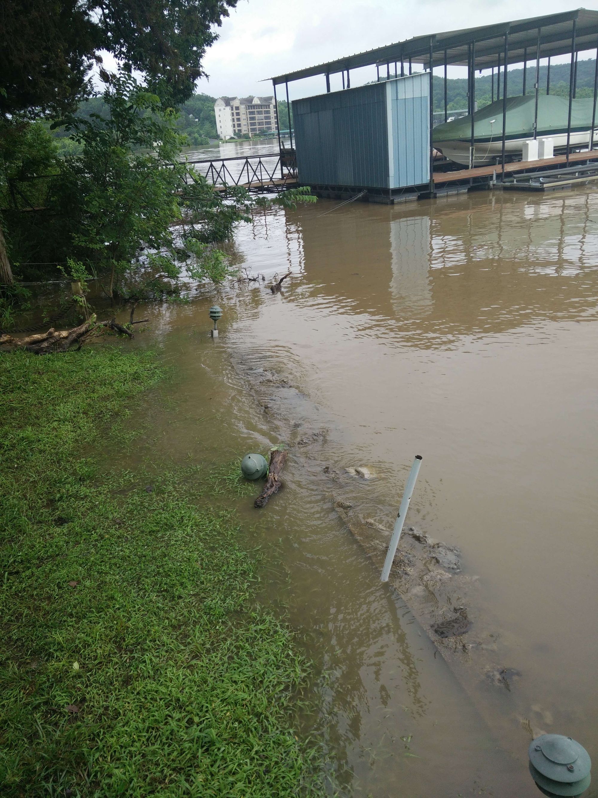
The attached part of the dock (the not floating part) was submerged underwater which had shorted out and killed all the power to the lifts and lights on both the swimming dock and boat dock. The raised water level over the seawall was also damaging all the soil that was not meant to be submerged causing erosion in parts of it.
Back then I thought this was insane - the water level was so high that even driving through town you could see homes that the water was touching the foundation. Our place was lucky in that we still had easily 3-5 feet in elevation left to go prior to the house.
So I did some research 7 years later. Turns out the lake prefers to stay at the dam at around 658 feet, but it could be found at 655 feet at different points in the season. So that 3 foot difference probably explains the "low" and the "high" points I remember being at.
What was lodged that day was 662 feet, a staggering 5 feet jump in the normal maximum of the lake and what I soon learned was 2 ft higher than the absolute max.
I started trying to figure out why this happened when there was a dam to regulate the water level. It turns out after finding this wonderful PDF by Ameren, I learned a good bit of history about the dam.
When the Bagnell Dam was built in 1929 - its primary purpose was electrical power generation and it could fluctuate between 630 feet and 660 feet. It started as a motto of "water in" and "water out", but this had such terrible downstream damage if the incoming water was more than the downstream could handle.
This is what led to the creation of the upstream Truman Dam, whose primary purpose was flood control instead of power generation. I'm guessing here, but I guess that is why Truman Lake is so beautiful and different - they must restrict dock building so they have the ability to swing the water level way more.
Bagnell wanted to do that and actually had the ability to do so, but it was quickly realized with the tourism that changing lake levels at extreme levels would damage all the constructed ecosystem around the lake. So tons of meetings were had that basically regulated the Bagnell Dam to stay between 645 ft as the absolute low and 660 ft as the absolute high. With a 15 feet range - contractors, regulation and buildings could work to build safe construction, but in actuality the common range ended up being 653 to 658 feet.
So I wondered how this random July 2015 matched up to the highest levels over time.
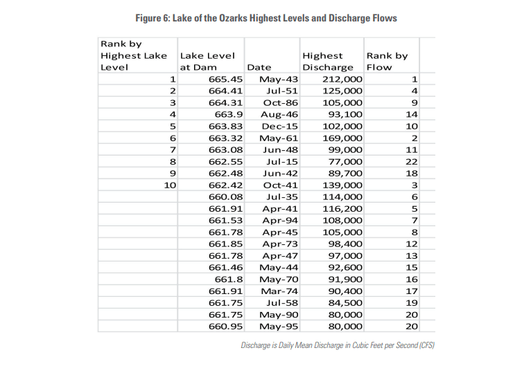
What is interesting is most of the highest levels were between 1940 and 1945 - which correlates directly to World War II. As high water levels provided the maximum power generated from the generators.
If you ignore those you can see 2015 was a crazy year with both July and December having top 10 water levels. December peeked at 663 feet, an entire feet higher than July 2015. Reading online about this has a variety of explanations.
- Global Warming.
- More industrialized cities removing flood pains.
- Natural ebb and flow of planet.
- Fault of x/y/z company.
So what exactly happened in July 2015? In short - a ton of rainfall and not just at once. The Truman and Bagnell Dam cannot make sweeping changes based on hunches of weather - this is because any change can either damage upstream or downstream. Take the estimated in July 2015 which was 1 - 3 inches of rain, but what actually happened was 9 inches.
Now you can get into immense amount of science here with understanding flood pools, stored water and balancing communication between dams. However, when rainfall continues to fall at huge amounts more than expected - bad things happen. Something had to suffer and there were many options.
- Truman holding back more water would flood additional areas.
- Truman releasing more water would add additional flooding to Bagnell.
- Bagnell holding back more water would flood docks and homes.
- Bagnell releasing too much water would flood downstream.
So we look back at July 2015 when the lake hit 662.55 feet, which is 2.5~ feet above the absolute maximum regulated. Now not having any background in this - I'm unsure if a 1 foot rise at the dam equals a 1 foot rise everywhere, but I do know this water level was the most dangerous I've ever seen it.
So if I turn back the clock to July 2015 - in that instant of this insane flood. I decide to go to the dam to investigate.
It seemed some roads were closed and I could not find the best way to get closer, so I just parked at the viewing center and took a photo.
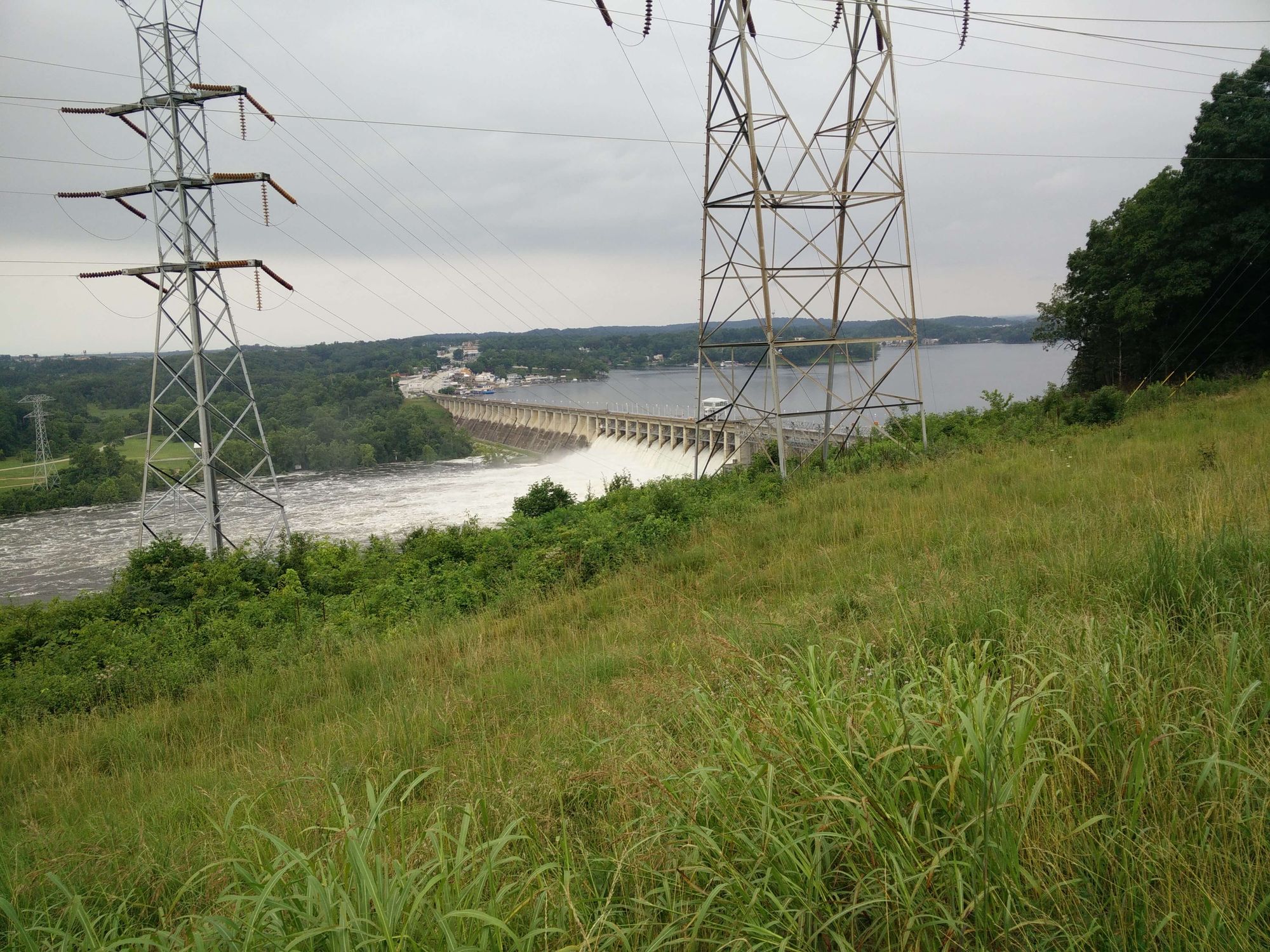
It was insanely loud and it was the first time I'd seen all the flood gates open. I wish I had taken more photos and or even recorded some drone photography, because I'm finding more often than not that photographing the past is worth it.
I had no idea it ended up flooding worse in December of 2015, but the place we visited was in the process of being sold - so the journey often to the Ozarks was over.